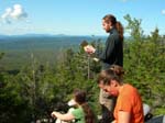
 On our first stop above the treetops, Paul consults his map. The correct direction to go is up. |
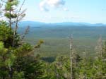 A view of the area as we start to head up the Abol Trail. |
 You can see the Abol Slide on the mountain above us. It begins to dawn on us that that is our trail. |
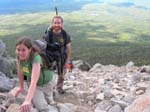
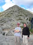
 Melanie and Paul with a beautiful view/ precipitous drop behind them. |
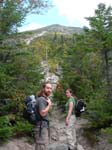
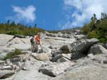 Meredith on the Abol Slide. The trail is only getting steeper. |
 This is about the point where Melanie realizes that going back down isn't any more promising than continuing up. |
 The trick to a trail like this is not looking behind you. |
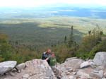
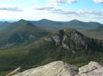
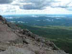 The Abol Slide with a great view of the lakes in the distance. |
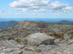 We reach the top of the Abol trail and arrive at the relatively flat Tableland. That's the Appalachian Trail (Hunt Trail) going off in the distance. |
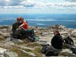 We take a much-needed rest at the Tableland. |
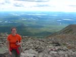 Meredith on her final ascent to the peak. |
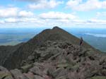
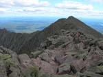
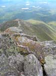
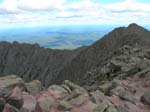 Success! A view of the infamous Knife Edge trail from the summit. The trail goes out to that smaller peak and then follows the ridge to the left. |
 Paul steps out onto the beginning (and widest part) of the Knife Edge. |
 Brian is very happy that this is as far as he needed to go in this direction. |
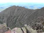 A sense of the drop below. |
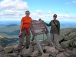
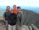 Group photo at the summit! |
 Brian and Meredith at the end of the Appalachian Trail. We're glad we didn't have to do the whole 2,000 miles to get here! |
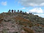 The summit is exciting not just for the views, but for the groups of hikers who are all very happy to be at the top! |
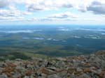 Speaking of the views….. |
 Starting down the Hunt Trail, we can see the steepness of the Abol Trail behind us. |
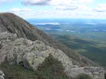
 So the bad news is…. We still have to get down. The Hunt Trail follows the top of this ridge. |
 After a grueling (and photo-free) descent down this slope, Brian and Melanie try to remember why they ever thought this was a good idea. |
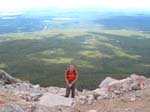
 When you have a frightening drop on three sides, the views tend to be pretty impressive. |
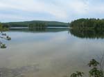 At last! Something flat! We reach the bottom and spend the next day relaxing by a pond and overdosing on pain relievers. |